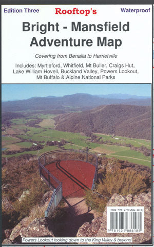
Rooftops Bright/Mansfield Adventure Map
Rooftops Bright/Mansfield Adventure Map is backordered and will ship as soon as it is back in stock.
Couldn't load pickup availability
Delivery and Shipping
Delivery and Shipping
Adventure Camping & Fishing offers the following shipping options via Australia Post:
- Free shipping for orders over $150
- Standard shipping: $15
Can't find what you're looking for? Give us a call on (03) 5722 4622.
Description
Description
Map coverage is from Myrtleford, Bright, Moyhu and Benalla in the north to Mansfield, Mount Buller and Wonnangatta Station in the south. It includes Whitfield, Harrietville, Buckland, Buffalo River, Mount Buffalo, Powers Lookout and part of the Alpine National Park. Scale is 1:100,000.
The reverse of the map has a 1:50,000 scale enlargement titled 'Bright - Whitfield Forest Activities Map' featuring Mount Buffalo National Park which is ideal for bushwalking.
Rooftop Maps are a recommended map for 4X4 to Buckland Valley, Buffalo Valley, Tolmie, Toombullup, Cobbler Lake, King River.
All parks, reserves and state forests are shown and all roads and tracks have been plotted using GPS mapping technology.
Listed with ExportYourStore.com
Payment & Security
Payment methods
Your payment information is processed securely. We do not store credit card details nor have access to your credit card information.

